Public Infrastructure|2019|Completed
Granger Lake Management Office Building Design
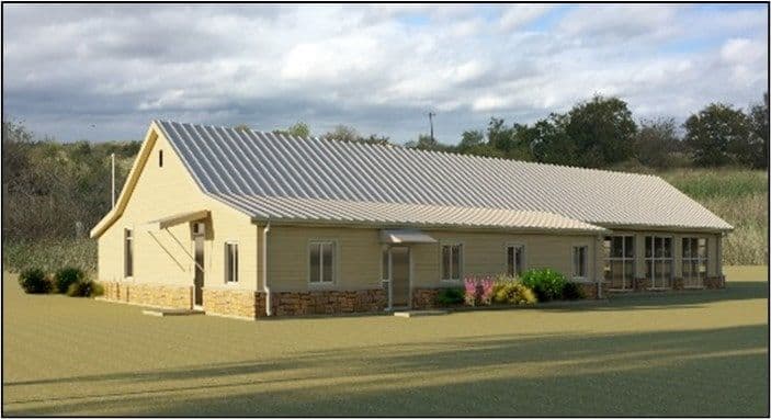
The previous facilities for the Lake Management staff at Granger Lake have been in a state of disrepair for a number of years. MSMM Engineering was been tasked by the USACE Ft. Worth District to design new facilities for the Granger Lake management staff to utilize for operability of the lake. Granger Lake Management Office design package was completed before the end of the Federal fiscal year in 2019, and consisted of the development of a construction package for the remediation and demolition of the existing 5,890 SF lake management facility located at 3100 Granger Dam Road, Granger, TX, and the design of a new facility across Granger Dam Road from the existing facility. The new facility is one story and was designed for approximately 4,856 SF in gross area. The design package for the new facility includes site development, new construction inclusive of all required services (i.e. electrical/mechanical/ fire protection/life safety/civil/structural/architecture). Design activities also included the design of landscaping, new paving, paving repairs, and force protection. The new facility houses offices for lake management staff, and a conference room to accommodate up to 60 people with tables and chairs. Site lighting was designed, along with parking for visitors and staff. Additionally, the fencing design required for the government vehicle and equipment compound behind the new office, was designing and included with the construction documents.
As mentioned above, MSMM completed all of the mechanical design for this facility. The mechanical design consisted of heating, ventilating, air conditioning, refrigeration, energy, piping and plumbing systems. Mechanical design for the facility complied with the following codes: International Mechanical Code (IMC), International Plumbing Code (IPC), National Fire Protection Association (NFPA), Sheet Metail and Air Conditioning Contractors National Association (SMACNA), American Society of Heating, Refrigerating and Air Conditioning (ASHRAE) and the Americans with Disabilities Act (ADA). For HVAC, the facility was designed to utilize a standard split system style direct expansion system with indoor air handling units and outdoor condensing units with one system dedicated to providing conditioned outside air to the space. The indoor units utilize electric heat strips for winter conditions. Generally, the building was designed to be conditioned by multiple direction expansion coil type air handing units with electric heat. For exhaust, the Men and Women restrooms, Janitor Room, and Lobby restroom exhaust system were all designed to discharge through a single roof penetration located near the restrooms.
Sanitary sewer was designed so that sewer waste discharges to a single point located along the North end of the building. The following sanitary sewer fixtures were included with the design package: Two Compartment Sink (Break Room -1), Lavatories (Women, Men and Lobby Restrooms – 5), Flush Valve Water Closets ( Woman, Men and Lobby Restrooms – 6), Floor Drains (Women, Men and Lobby Restrooms – 4), Urinal – Flush Valve (Men Restroom), High/Low Drinking Fountain (Rear Lobby – 1), Service Sink (Janitor Closet -1), Condensate Discharge from AHU’s located above ceiling – 2, and discharge from the ice machine (break room – 1).
Granger, TX